


East Stromberg Precinct, Polk County, Nebraska
About
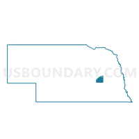
Outline

Summary
| Unique Area Identifier | 613741 |
| Name | East Stromberg Precinct |
| County | Polk County |
| State | Nebraska |
| Area (square miles) | 30.32 |
| Land Area (square miles) | 30.27 |
| Water Area (square miles) | 0.05 |
| % of Land Area | 99.82 |
| % of Water Area | 0.18 |
| Latitude of the Internal Point | 41.09806680 |
| Longtitude of the Internal Point | -97.54935730 |
Maps


Graphs
Select a template below for downloading or customizing gragh for East Stromberg Precinct, Polk County, Nebraska


Neighbors
Neighoring Voting District (by Name) Neighboring Voting District on the Map
- South Canada Precinct, Polk County, NE
- South Osceola Precinct, Polk County, NE
- Thayer-Morton Precinct, York County, NE
- West Stromberg Precinct, Polk County, NE
Top 10 Neighboring County Subdivision (by Population) Neighboring County Subdivision on the Map
- South Canada precinct, Polk County, NE (1,201)
- South Osceola precinct, Polk County, NE (1,090)
- East Stromsburg precinct, Polk County, NE (774)
- West Stromsburg precinct, Polk County, NE (750)
- Thayer precinct, York County, NE (221)
Top 10 Neighboring Place (by Population) Neighboring Place on the Map
Top 10 Neighboring Unified School District (by Population) Neighboring Unified School District on the Map
- Centennial Public Schools, NE (3,378)
- Cross County Community Schools, NE (2,202)
- Osceola Public Schools, NE (1,612)